


There's not an easy way out of this, thanks to a 4-5 foot snow drift near Ludlow, S.D. (Photo: Joyclyn Mollman via The Weather Channel Facebook page)
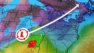
Winter Storm Xenia produced whiteout conditions across large swaths of North Dakota, South Dakota, and northeast Wyoming on the final day of March 2014.
Monday morning, visibility was reduced to 10 feet in parts of North Dakota. Drifts of 5-6 feet were observed in Roseau, Minn. Winds gusted to 64 mph at the Rapid City, S.D. airport, and up to 58 mph near Oakes, N.D.
Whiteout conditions prompted a shut down of Interstate 29 from Brookings, S.D. to the Canadian border, and Interstate 94 from Fargo to Bismarck, N.D.
Xenia prompted the 11th separate blizzard warning in the winter season issued by the National Weather Service in Grand Forks, N.D.
Thundersnow was reported in Valley City, Tower City, and Mayville, N.D., as well as in Crookston, N.D.
Here is a list of peak totals, by state, from Winter Storm Xenia as of Tuesday morning:
North Dakota:20" in GraftonMinnesota:18" in Thief River Falls and near WarrenSouth Dakota:10" in SissetonWyoming:15" near CentennialMontana:12" near Carlyle and St. PhillipNebraska:5" in Arthur
Below is a list of snow totals in larger cities in the northern Plains and Upper Midwest:
Bismarck, N.D.: 8.1"Grand Forks, N.D.: 11.5"Fargo, N.D/Moorhead, Minn.: 2.5"Rapid City, S.D.: 1.9"Pierre, S.D.: 6"International Falls, Minn.: 2.1"Duluth, Minn.:1.7"
Some light icing of roads was reported in parts of northern Minnesota, including near Two Harbors and Illgen City. Up to two-tenths of an inch of ice and sleet accumulation was measured in Wadena, Minn.
If that wasn't enough, a rare March tornado touched down in extreme west-central Minnesota near the town of St. Leo. Prior to this tornado, only 20 March tornadoes had been observed in the state of Minnesota dating to 1950. Fourteen of those were during the Mar. 29, 1998 St. Peter/Comfrey outbreak, according to the National Weather Service in Chanhassen, Minn.
A tornado warning was also issued in the afternoon for Brookings County, S.D. Just over three hours later, a blizzard warning would go into effect.
(MORE: 10 Cities Winter Spared | 10 Worst Winter Cities)
A car is almost completely covered up by snowfall from Winter Storm Xerxes on Monday, April 15, 2013. (Facebook/Debbir Kaminski)


 zpostcode
 Recruit
 weather
 mreligion
 Yellowpages
 sport
sport constellation
 shopping
 name
name game
game directory
 literature
 Word
Word tour
tour furnish
 Lottery
 tftnews
 lyrics
 News
News digital
 car
car dir
dir Edu
Edu Finance


