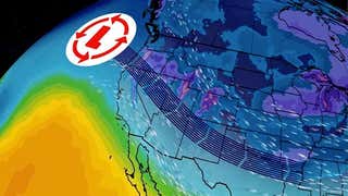


Editor's note: The following information was valid at the time Khan was named at 10:30 a.m. Eastern time Friday. For the latest information, read our latest update on Winter Storm Khan here.
The Weather Channel has named the current winter weather system affecting the Southeast and Mid-Atlantic Khan based on the following potential impacts:
As much as 0.50 inch of ice accumulation which may lead to power outages in addition to major travel issues. Also 2 to 4 inches of snow from Ohio through the Mid-Atlantic region including Washington D.C. on north side of storm.
Significant icing will affect an area from eastern Tennessee and Kentucky through North Carolina and northern South Carolina. Snow will impact areas from the Ohio Valley through western Pennsylvania, West Virginia and Virginia.
Friday late morning hour through Friday night.
The combination of a higher precipitation amounts and colder air at the surface for a longer period of time will increase the threat of impacts from significant icing for a large area across parts of the Southeast. Low visibility and slick roads will lead to traffic issues in snowfall across the Ohio Valley through Mid-Atlantic.


