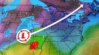


Winter Storm Hercules delivered a swath of snow from the Midwest to the Great Lakes and Northeast during the first few days of 2014. Below are snowfall totals produced by Hercules as of Jan. 3.
Nebraska
3.1" near Auburn in southeast Nebraska1.2" in Omaha
4.5" near Glasco2.0" in Salina1.5" in Topeka
4" in Spanish Lake3.1" in St. Louis0.5" at the Kansas City International Airport
4.7" in Fayette3.1" at the Davenport Municipal Airport2.2" at the Des Moines International Airport
18" near Gurnee13" in Evanston10.9" at O'Hare Airport
10.3" near Racine8.1" in Milwaukee
12" in La Porte6.1" in Indianapolis
12.1" near Stevensville11.1" at Detroit Metropolitan Airport
9.4" in Toledo4.2" in Cincinnati (CVGInt'l Airport)3.3" in Columbus
4.3" near Francisville
10.1" in Clifton Heights9" in Philadelphia7.2" in Allentown
6.5" in Columbia4.2" in Baltimore
8" in Odessa9.4" in Dover
22" in Greece10.9" at the Rochester International Airport7.8" in Buffalo6.4" in New York City (Central Park)
11" in Long Branch8.5" inNewark6.5" in Atlantic City
23.8" in Boxford23.5" inTopsfield17.8" in Boston
9.5" in Darien9.5" in Milford7.2" in Windsor Locks4.7" in Bridgeport
11" in Pawtucket8.5" in North Providence7" in Cranston
17" in Woodford11" in Pownal
12.2" near Newbury9.5" in Peterborough7.8" in Manchester
11.6" inPortland9.3" in Gorham
MORE ON WEATHER.COM: Photos of Winter Storm Hercules
This image taken on January 3, 2014 by the Suomi NPP satellite shows the blanket of snow that stretches from the Midwest across to New England after a massive winter storm moved over the region on January 1-3, 2014. (Source: NASA/NOAA)


