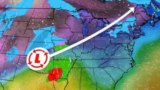

Snow from Winter Storm Regis ended on Monday across eastern New England as low pressure moved away.
(MORE:Latest Regis Impacts/News)
More than ahalf footof snow piled up in parts of eastern Connecticut, eastern Massachusetts, extreme southeast New Hampshire and eastern Maine from Regis.
Regis first brought snow to parts of the Rockies, including Denver, Thursday into Friday. Light snow accumulations were reported from Regis on Saturday in the far northwest suburbs of Washington, D.C. and parts of the central Appalachians through Sunday. Light snow then grazed the Baltimore to Philadelphia corridor and points east across the Mid-Atlantic Sunday night.
(MORE:How Winter Storms are Named)
Eastern States Recap:
Here are some of the top snowfall totals by state from Regis in the East.
Connecticut: 6.5 inches in TollandMaine:10.1 inches in Grand Lake StreamMaryland: 4.5 inches in OaklandMassachusetts: 7.5 inches in OakhamNew Hampshire: 8.5 inches near StrathamNew Jersey: 2 inches in NeptuneNew York: 3.5 inches in Port JeffersonNorth Carolina: 6 inches in Newfound Gap (elevation of 5,049 feet)Pennsylvania:2 inches in Hidden ValleyRhode Island: 6 inches in BurrillvilleVirginia: 4 inches near LindenWest Virginia: 7 inches near Cherry Grove
Rockies Recap:
Storm-prone Interstate 80 was once again shut down due to snow and wind fromRawlinsto Laramie, Wyoming Thursday night into early Friday, but has since reopened.
Snow from this system impacted the Rockies and central High Plains, with some snow inching across the state of Kansas early Friday.
Some top snowfall as of Friday night include:
18.2 inches at Rabbit Ears, Colorado.16.9 inches at Tower, Colorado.13.0 inches near Boulder, Colorado.10.5 inches at Aspen Springs, Colorado.0.3 inches near Milberger, Kansas.
Nor'easters are often a forecast challenge, but this particular system gave meteorologists whose task is to interpret various computer forecast model guidance into forecasts a headache.
One of the reasons for the uncertainty was a complicated upper-level pattern.
It wasn't simply just one upper-level system giving birth to offshore low pressure, but rather a complex interaction of (A) a digging shortwave trough from the Rockies, (B) a remnant circulation from a stalled gyre of low pressure over the Upper Midwest and (C) a sharp southward dip in the jet stream nosediving southeastward from Canada.
The other challenge was simply that it's late in the "snow season". Air masses by early spring are typically only marginally supportive for snow in lower elevations.
A man rollerblades near the Bethesda Terrace in Central Park, Manhattan, New York City, March 9,2016 as people take advantage of the warm weather in the city.
(TIMOTHY A. CLARY/AFP/Getty Images)
Furthermore, the lack of snowcover thanks to the recent warmth since February has allowed ground temperatures to remain rather warm, which would serve to, at least initially, melt the first flakes of snow hitting the ground.
Speaking of recent warmth, consider what we've seen recently in the East:
A record warm December-February in New England, and one of the warmest on record in much of the East.A rash ofsevere thunderstorms as far north as Maine in late February.The warmest temperatures so early in the season on March 9in the Northeast, including low 80s in Albany, New York.Through March 16, this has been the least snowy season-to-date in both Albany, New York (10.3 inches), and Binghamton, New York (22.3 inches).


